LOW BASE CLOUDS Base Level 0 to 3000 metres (0 to 9800 ft)
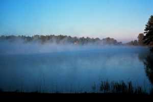
FOG
A low stratus cloud in contact with the ground. Photo is of thin radiation fog bank.
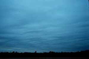
STRATUS
The lowest clouds, often appear as an overcast deck but can be scattered patches. Individual cloud elements have very ill-defined edges.
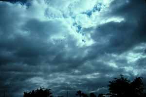
NIMBOSTRATUS Very dark clouds associated with large areas of continuous precipitation. Although bases are usually low, their vertical extent often extends well into the middle cloud region.
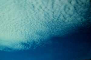
STRATOCUMULUS Elements in tight clusters with very little vertical development. Relatively flat lacking the sharp edged, popcorn appearance of cumulus clouds.
MIDDLE BASE (ALTO) CLOUDS Base Level 3000 to 7000 metres (9800 to 23,000 ft)
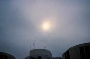
ALTOSTRATUS
Uniform and diffuse coverage where it is difficult to detect individual elements or features. Grey or bluish in colour.
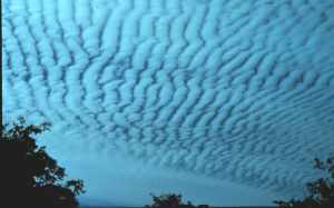
ALTOCUMULUS Distinct cloud elements are either a sheet or a patchy deck with waved bands, rolls, or rounded masses. Elements usually sharply outlined.
ALTOCUMULUS Distinct cloud elements are either a sheet or a patchy deck with waved bands, rolls, or rounded masses. Elements usually sharply outlined.
HIGH BASE CLOUDS Base Level Above 7000 metres (Above 23,000 ft)
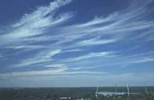
CIRRUS
Composed of ice crystals in the form of delicate filaments, patches or bands.
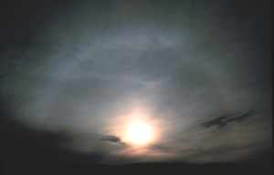
CIRROSTRATUS
Ice cloud forming transparent cloud veil of fibrous or smooth texture, partially or totally covering sky.
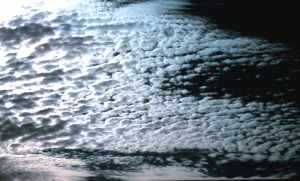
CIRROCUMULUS
Ice cloud composed of small elements in form of separated patches, ripples, fish scales etc., more or less regularly arranged.
LOW BASE CLOUDS WITH LARGE VERTICAL EXTENT Base Level 500 to 3000 metres (1600 to 9800 ft)
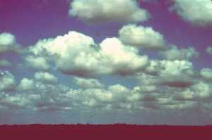
CUMULUS HUMILIS Small heap clouds with flat bottoms and slightly rounded tops
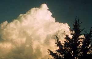
CUMULUS CONGESTUS Heap clouds of both great vertical and horizontal extent, looking like a cauliflower. Bottoms sharp; tops rounded with sharp outline.
CUMULUS CASTELLANUS
Heap clouds of great vertical extent, looking like a castle tower. Bottoms sharp; tops rounded with sharp outline.
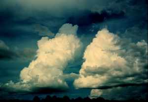
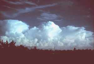
CUMULONIMBUS Tallest of all clouds, may extend to over 18,000 m (60,000 ft). Appear as mountains or high towers. Usually have large anvil-shaped tops of ice.
SPECIAL CLOUD FORMS
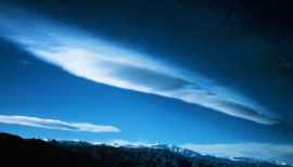
LENTICULAR CLOUDS Often saucer-shaped, they form in the crests of atmospheric waves, commonly occurring as air passes over high mountain peaks.
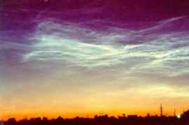
NOCTILUCENT CLOUDS
Ice clouds forming transparent cloud veil at altitudes above 80 km (50 miles), so thin stars can often shine through.
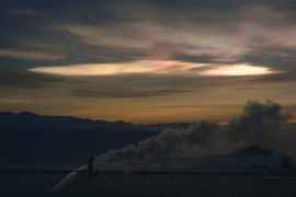
NACREOUS CLOUDS Or Mother-of-Pearl clouds are a stratospheric ice cloud formed at altitudes of 15-30 km (10-20 miles). They are the polar stratospheric clouds associated with ozone destruction
All Photos Courtesy of NOAA/US Department of Commerce, except noctilucent clouds which are Courtesy Space Research Institute (Russia)
Learn More From These Relevant Books Chosen by The Weather Doctor
Day, John A.: The Book of Clouds , Sterling, 2005, paperback, ISBN 0760735360.
For More Weather Doctor articles, go to our Site Map.
I have recently added many of my lifetime collection of photographs and art works to an on-line shop where you can purchase notecards, posters, and greeting cards, etc. of my best images.