| Home | Welcome | What's New | Site Map | Glossary | Weather Doctor Amazon Store | Book Store | Accolades | Email Us |
 | |||||||||||||
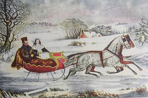
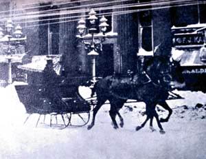
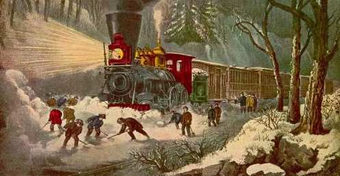
Weather Almanac for December 2011CHRISTMAS STORMSAs I sit down at the computer to write this last installment of the Weather Almanac for 2011, it is a day before the US Thanksgiving holiday begins, and outside my window, strong winds are blowing a snow and rain mix between the houses. The situation fits the local definitions of a blizzard if the visibility is low enough. I am quite content that I have nowhere to go today, no promises to keep, and as long as we keep power, I am able to write my monthly essay in peace.  Urban Blizzard: Painting by Keith C. HeidornThe situation has me thinking of holiday travel and the monkey wrench that the weather can throw at us during the season we most desire to travel to see family. And that does not mean long-distant, air travel only, for often trips of less than 50 miles (80 km) by road can become an adventure. One of my earliest such memories, though rather fuzzy, concerns a snowy drive home on Christmas Eve when I was a young. I had thought it to be a Christmas in the mid-1950s. The first part of the memory is clear: we attended a Christmas Eve get-together of my father’s family at his father’s home. That puts an upper limit on the date as grandpa died in November 1958. I remember we left there in the late evening, and there was quite a bit of snow on the ground and it was still falling making the trip home hazardous. What I am unclear about is the location of our home at the time: a few miles away in Chicago or much further off in suburban Palatine. But information posted by Chicago weathercaster Tom Skilling on his weather blog suggests it was much earlier: 1951. Skilling’s information derives from an answer to a comment/question from a reader of his webpage about Christmas snowstorms. Skilling wrote that there was a significant snowstorm in 1951 that began on Christmas Eve and ended the next morning. The city received a total of 8.6 inches with just a bit more than half falling on Christmas Eve. If this is indeed the storm of my memory, then we were heading back to nearby Norwood Park.
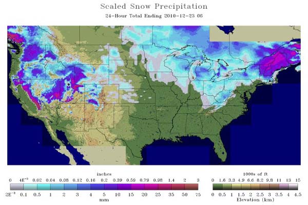
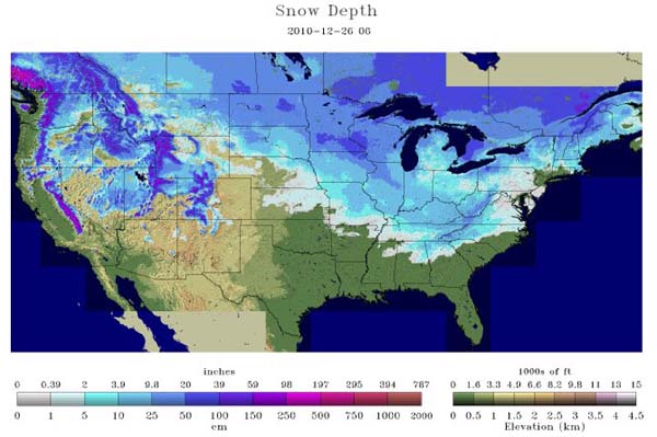
The Christmas Storm of 2010For the second time this year, my research for my Almanac essay showed me that a situation relevant to the topic occurred last year (2010). (The other I wrote on Heat Waves this past summer.) In searching for weather events for the December Weather Diary, I saw that major winter storms struck the eastern US, and the Canadian Maritimes, during the Christmas season. On December 21st, two storms affected the continent from the upper Mississippi Valley to the Atlantic Coast then northward across the Carolinas to the Maritimes. Also at this time, a major storm had hit the Pacific Coast with significant snowfalls in the California mountains of 12 inches (30 cm) or more. At Mammoth Mountain Ski Resort in the snowy Sierras, over 160 inches of snow fell over five days. 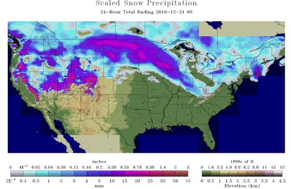 Snowfall across the US on 21 December 2010 |
|||||||||||||
 |
 |
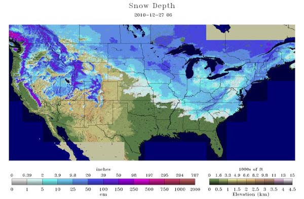 |
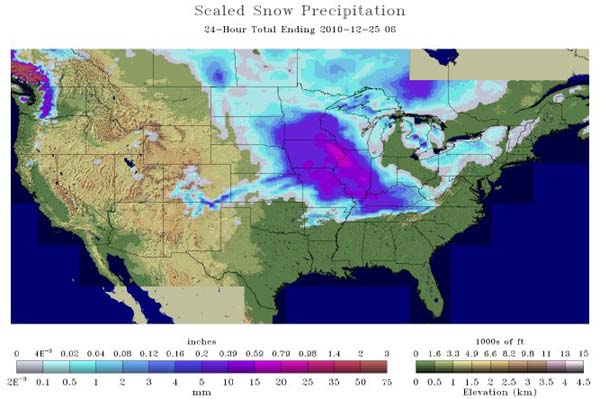
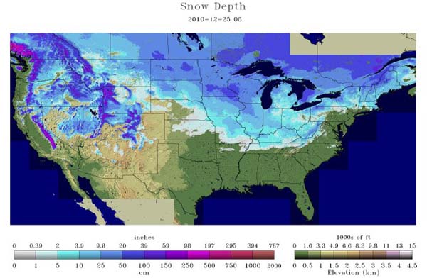
Images of Snow Depth Across the US |
The storm moved into Atlantic Canada paralyzing the region with the fourth major storm in as many weeks. Western Prince Edward Island was buried under as much as 30 cm (12 inches) of snow with as much as 40 cm (16 inches) in northern New Brunswick. Winds in Newfoundland gusted to over 100 km/h (60 mph), peaking at 165 km/h (100 mph) in the Wreckhouse area. In Cape Breton, Nova Scotia, the precipitation fell as heavy rain with Ingonish Beach receiving 59 mm (2.32 inches) and Sydney, 58 mm (2.28 inches).
In the storm’s wake, the blustery winds continued to harass the US Northeast, drifting the powdery snow into piles as high as 6 ft (1.8 metres). Blizzard warnings remained in effect from New York City to Maine. As of midday on the 27th, storm snowfall accumulations reached:
Behind the storm in the strong cold air descending toward the south, morning temperatures in Florida on the 28th fell below freezing as far south as Miami with 39 locations setting new low temperature records for the day. At the opposite end of the coast, the final snowfalls in Maine set new daily total records at Rangeley, 12.5 inches (32 cm); Eustis, 12.2 inches (31 cm); and in Vermont at Pownal, 5.0 inches (12.7 cm).
The year would end with another round of blizzards moving across the US West and into the Midwest on the 30th and 31st. More alarming conditions hit New Years Eve as a tornado outbreak with 26 confirmed tornadoes struck across Illinois, Missouri, Arkansas, Oklahoma and Mississippi causing at least six fatalities.
The Christmas storms of 2010 were neither the only nor the worst to strike the United States at this festive time. The complete record is too extensive to fully document here, but as a holiday treat, I mention some that occurred prior to 1870, courtesy of David Ludlam’s two volume Early American Winters.
In the early days of the American Colonies and the Nation, a storm on or around the days celebrating Christmas did not have the impact it did after 1900, and often the cold was more important to diarists than snowfall. Travel between distant communities was not as common as now. Many extended families lived close to each other, and the majority of Americans never travelled far afield from their homes in any season. In fact, heavy snow was often looked on favorably as it made travel easier, and more comfortable, by sleigh than by carriage over the rough roads. In many areas, the work of local road crews was to add and smooth snow on roads rather than remove it.
The first mention of a Christmas storm I could find in Ludlam’s book came in 1704/05. A note in the Boston newspaper spoke of heavy snow, followed by a cold Christmas Day, then “a pritty [sic] deal of snow.” In New York City, locals commented that Christmastime was thought to have been the coldest ever felt there.” (Note that around this time there was a transition of calendars from Julian to Gregorian, and care must be taken in assigning dates. Ludlam chose to report the date whenever possible according to our current calendar. Therefore, during the winter 1704/05, Christmas would have fallen in our present calendar on January 5th.) Samuel Sewall noted in his diary of a “very great snow” three days before Christmas (2 January) with Christmas Day being “Very cold day but serene morning. Sleds, sleighs and horses pass as usual and shops open.”
The Winter of 1747/48 was known as the “Winter of the Deep Snows.” An unknown poet from Newbury, Massachusetts described Christmas Morning 1747 thus:
“The snow lay deep in drifts upon the ground
The road unbroken no one could discern
‘Twas hill and vale in deep untrodden snow.”
A major nor’easter hit southern New England on Christmas night 1764, sweeping up the entire coast. In Philadelphia, Christmas night had “a violent windstorm and snow.” In Massachusetts, the storm caused much damage along the coast. In Bedford, New Hampshire, the snow cover exceeded two feet (60 cm). Reverend Smith in Portland, Maine put the total there at 2-3 feet (60-90 cm).
In the early days of the War of Revolution, a Christmas snowstorm hit the southern colonies beginning around 23 December known in war annals as the “Snow Campaign.” The diary of John Drayton has this entry for the 23rd describing the weather in western South Carolina: “The stormy weather continued and the snow fell 1˝ feet [45 cm] deep.” In Georgia, according to Captain Hugh McCall, “On the night of the 25th was a great fall of snow, supposed to be deeper on the ground, than what was ever witnessed. In the southern provinces of Georgia it was generally eighteen inches [45 cm] deep; …” The storm system likely extended back into the northern colonies where Henry Knox was struggling to move captured cannons from Fort Ticonderoga to Boston. He reported two feet (60 cm) of snow by Christmas Day near Albany, New York.
Stormy conditions in 1776 around Christmas Day allowed General George Washington to cross the Delaware River to surprise the Hessian garrison in Trenton, New Jersey. One of his staff noted at 6 pm on Christmas Day, “It was fearfully cold and raw and a snowstorm settling in. The wind was northeast and beats in the face of the men. It will be a terrible night for the soldiers who have no shoes.” Snow fell that day all along the coast. Shoe-top snow was reported from Salem, North Carolina and more than a foot (30 cm) at Friedberg. Thomas Jefferson at Monticello observed the snow as 22 to 24 inches (55-61 cm) deep. Lesser amounts fell to the north as the storm raged up the coast, but when Washington’s troops pushed back across the river after their surprise attack, they marched through rain, snow and sleet. The morning of the 27th saw bitter cold and foot-deep snow at Trappe, Pennsylvania, 35 miles west of Trenton and northwest of Valley Forge.
Two years later, the “Hessian Storm” struck southern New England coastal areas around Christmastime. Dr Edward Holyoke of Salem called it “a very great storm. Snow. Very high wind. Excessive cold” — a true Eastern blizzard. Christmas morning 1778 ranks as one of the coldest Christmases in New England history. John Winthrop at Harvard Yard observed the temperature as -8° F (-22° C) that morning, and a New Haven, Connecticut, Ezra Stiles measured a -3° F (-19° C) low. In Newport, port wine froze in its bottles as did various pickles. In New York City, Lt Col. Kemble wrote in his journal “Deep snow and bitter cold.” Lt Frederick Mackenzie of the Royal Engineers in Newport noted 18 inches (45 cm) of snow by six in the evening of the 26th after a day of heavy snowfall, howling winds, and heavy drifting. By the following day, he noted drifts had risen to 20 feet (6 m) in places. The name “the Hessian Storm” arose from the death of nine Hessian soldiers from the severe weather at Newport; historical records indicate as many as fifty people died in the area due to the cold.
A nation established, the first remarkable Christmastime storm of the United States savaged the waters and shores of Long Island, New York in 1811 beginning on Christmas Eve. The storm, combining heavy snow, gale-force winds, and sub-zero Fahrenheit temperatures, struck suddenly following a day of “remarkably warm and fair” weather. As the storm raged unceasingly for 24 hours, between 50 and 60 sailing vessels foundered in Long Island Sound. The “Day-Before-Christmas Storm” has been well documented by Dr Samuel Mitchell, a New York scholar and scientist, and later a US Senator, with an interest in meteorology. The storm deserves a more lengthy treatment, than I give here. Ludlam likens it to the Hessian Storm of 1778, the Cold Storm of 1857, and the Great Blizzard of 1888 in the region. The storm generally dumped a foot of snow across southern New England and southeastern New York. Nathaniel Prime noted in his history of the region “And no man that spent that day as the writer spent it, will ever hear that always unappropriate [sic] comment “a merry Christmas” without conscious pain.”
The Christmas Season of 1839 experienced two major storms, which bracketed the Christmas holiday. The first arose south of Washington DC in the early hours of 22 December and appears to have been a classic Nor’easter. It buried the nation’s capitol with 10 inches (25 cm) of snow and then moved up the coast leaving south-central Pennsylvania and northeastern Maryland with over two feet (60 cm) of snow in some places such as Gettysburg. Drifts piled high as the strong northeast winds howled ahead of the storm. Estimates in Baltimore, Maryland suggest the area averaged 16 inches (41 cm). A severe gale with snow began in the afternoon of the 23rd in New York City and continued into the evening with a seven-inch (18 cm) accumulation of snow. The storm then headed out to sea and spared southern New England from its worst. Boston, Massachusetts reported only about an inch (2.5 cm) of accumulation. Hartford, Connecticut’s lighter snowfall drifted heavily; and Providence, Rhode Island measured three inches (7.5 cm) of snow.
The winter storm, another Nor’easter, which followed the above, began on the 27th in the Washington DC area with snow and gale winds. A few hours after the storm began in Washington, snow began in New York City but later changed to rain. A total accumulation of 2.22 inches (56 mm) of precipitation there indicated a high moisture content in the storm available for inland snow. Wind and pressure observations suggest that this storm ran up to coast overland rather than offshore. The storm began in southern New England on the evening of the 27th and raged on overnight. Providence reported 1.12 inches (28 mm) of rain and a drop in barometric pressure of 38 mb during the day to 976 mb. The Nantucket Inquirer reported the night of the 27th was “one of the most violent within the recollection of the oldest inhabitant.” Enoch Hale at Nantucket’s Academy of Arts and Sciences, reported the barometer fell from 1028 mb on the morning of the 27th to 974 mb the evening of the 28th.
The New Hampshire Sentinel out of Keene reported the wet snowfall totaled 12 to 15 inches (30-38 cm) and two feet (60 cm) at Chester, Vermont. The Litchfield Inquirer reported that heavy rain fell across eastern Connecticut but in northwestern Connecticut, the average snow depth ran from three to four feet (90-120 cm) with drifts four times that deep. Similar depths were reported from Goshen, Massachusetts in the Berkshire Mountains. From Randolph, Vermont in the Green Mountains, an observer measured 16 inches (41 cm). In upstate New York, there was one word to describe the scene: SNOW. In Genesee County, 28 inches (71 cm) accumulated over 56 hours. The storm brought lake-effect snows in its wake to Buffalo and Wyoming County that combined to measure 36 inches (91 cm) at Middlebury Academy and 30 inches (76 cm) across the city. Geneva, New York received three feet (91 cm) in 48 hours. Though New York City saw mostly rain, 55 miles (88 km) to the north of Manhattan, the community of Montgomery received a foot (30 cm) of snow on the 27th and an additional 20 inches (50 cm) the following day.
Several other holiday storms of more recent vintage should be mentioned because of their uniqueness.
The greatest 24-hour snowfall in local history buried Oklahoma City, Oklahoma beginning on Christmas Eve 2009, leaving an amazing 14.1 inches of snow on Will Rogers World Airport.
The Christmas Eve Snowstorm of 2004 was special because of its location, hitting the Gulf Coast of Texas and Louisiana before heading to the East Coast. Snowfalls here are very unusual coming once every couple decades. Brownsville, Texas picked up 1.5 inches (3.8 cm) of snow in the storm, the first snowfall their since the Great Cold Snap and Blizzard of 1899. The storm brought many locations, most notably Houston, Texas (1 inch/2.5 cm), their first White Christmas in history and the first measurable snow there since 1960. Elsewhere in Texas, Corpus Christi saw 5.2 inches (13.2 cm) and Victoria, 13 inches (33 cm). In Louisiana, New Orleans saw 0.7 inches (1.8 cm) and Lake Charles, 1.2 inches (3.1 cm). For residents of the Big Easy, it was the first Christmas snow in half a century and the first snowfall in the city in 15 years. New Orleans' transit system halted all buses and streetcars.
Lake effect snowfalls are no stranger to Buffalo, New York, but on Christmas Eve 2001, a five-day blast shut down the city as an officially reported 81.5 inches (207 cm) buried the city. At least four deaths were blamed on the weather and over $10 million was needed for clean-up.
A massive winter storm produced a white Christmas in showy Las Vegas, Nevada for the first time on record on 25 December 1988.
 The Christmas Eve Blizzard of 1982 in Denver, Colorado shut down Stapleton International Airport for 33 hours, stranding thousands as snowfall rates of 2-3 inches (5-8 cm) per hour and winds of 50 mph (80 km/h) piled the snow into drifts of 4 to 10 ft (1.2 to 3.0 m). In total, Denver had 25 inches (63.5 cm) while nearby sites measured 48 inches (122 cm) at Golden Gate Canyon; 34 inches (86 cm) at Littleton; and 29 inches (74 cm) at Thornton. Municipal reaction to the storm did not sit well with voters and in the spring, they voted out long-term mayor Bill McNichols.
On 26 December 1947, a late Christmas snowstorm buried Central Park in New York City under 26.4 inches (61 cm) of white while as much as 32 inches (81 cm) fell in suburbs.
In Canada, on central Vancouver Island, a major dump of snow descended on the Mount Washington Alpine Resort beginning Christmas Eve 2010. The storm left more than 3 meters (10 feet) of fresh snow on the Vancouver Island ski site. Many cars were buried in the parking lot and had to be located before they could be dug out. After the storm, the resort's snow depth measured 520 cm (205 inches), the deepest snowpack of any ski resort in the world at the time.
One of Canada’s most famous Holiday Season storms struck Victoria and Vancouver, British Columbia between the Christmas and New Years Holidays in 1996. The storm dumped over a metre (3 ft) of snow in otherwise green Victoria and curtailed many New Year’s Eve celebrations. In one 24-hour period, 80 centimetres (31 inches) of snow fell on downtown Victoria. The area was completely shutdown for several days as all ground transportation ceased. For details on this storm, see Victoria's Blizzard of '96
A decade earlier, freezing precipitation rained on Christmas Eve 1896 in Ottawa and surrounding areas. Fourteen hours of freezing rain left a quarter of Ottawa homes without power, forcing many residents to barbecue their holiday turkey.
In the United Kingdom, a notable holiday storm (24-26 December) in 1927 became the worst Christmas Blizzard in a century. While most of the country experienced some snow, the southern regions took the brunt of the storm with drifts in places reaching 4.5 m (15 feet) or more. Many roads were blocked with stranded vehicles. The deep and drifting snow cut off the village of Findon. One hundred men were employed to remove the great snowfall from area roads.
And finally, Christmas storminess in 2010 was not restricted to North America. In Paris, France, around 5000 holiday travelers were stranded overnight in Charles DeGaulle Airport by snow and ice that grounded 400 flights. The additional 5 cm (2 inches) of snow on top of the 60 cm (2 ft) of snow on one terminal roof sparked concerns over its safety and nearly 2000 were evacuated.
 |
Now AvailableThe Field Guide to Natural Phenomena: |
Now Available! Order Today! | |
 |
 |
Now |
The BC Weather Book: |


 Other memorable Christmas-season winter storms, during which I was travelling longer distances, crossed the Illinois/Michigan region in both 1969 and 1970. The earlier date dumped enough snow on Ann Arbor, Michigan on the day we planned to leave that my wife and I turned back and waited for the storm to pass and roads to be cleared. The latter trip was a more mixed precipitation storm that we encountered as freezing rain in northern Indiana that forced us to overnight in a motel with our newborn daughter.