| Home | Welcome | What's New | Site Map | Glossary | Weather Doctor Amazon Store | Book Store | Accolades | Email Us |
 | |||||||||||||||||||||||||||||||||||||||||||||
Weather Almanac for August 2009LOOKING AT CLOUDS: FROM BOTH SIDES NOWMany weather events arise when a number of elements, often contrasting, come together and interact. So too, this installment of Weather Almanac came together as a result of several influences on me in the past month. I move away from describing weather science and history a bit and write a more philosophical musing combined with a good dose of plain old looking, ideal for evening pondering on a warm summer’s night. So forgive the occasional ramblings, that is just how my mind works sometime. Hot summer weather has finally arrived here in the Robson Valley of east-central British Columbia, and the cumuli bloom daily over the Canadian Rockies and northern Columbia mountain ranges. Often, I see another skyscape or cloud formation that I would like to paint. With this wonderful weather for sitting quietly and watching the sky and other of nature’s bounty, I have time to ponder and gaze skyward, letting my mind ramble. Ideas race through my head, often augmented by song phrases. One such song is Joni Mitchell’s classic “Both Sides Now” and in particular, the lines: “I’ve looked at clouds from both sides now, from up and down….” 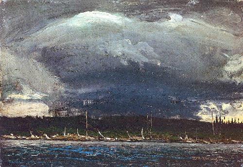 "Thunderhead" by Tom ThomsonThe “from down” part is easy to ponder as I look out over the skyline before me. And in looking at skyscapes, I am connected with recent sky art influences. The first began just after writing last month’s Almanac. I found that links in my Weather Painters article of several years back no longer connected with Phil Chadwick’s essay on “Creative Scene Investigation” or CSI. In it he discussed how famed Canadian landscape painter Tom Thomson so faithfully recreated his skies to the scene before him. As a result, Phil, a meteorologist as well as a painter, could accurately and in detail describe the weather scene in many of Thomson’s paintings as if he were viewing a weather map. Phil kindly allowed me to combine two of his Thomson essays for posting on The Weather Doctor. In my afterward to the piece, I included an image of Thomson’s Dawn on Round Lake. When Phil saw the painting, he rapidly sent back CSI notes on what he interpreted from Thomson’s work. I include that piece in the “Weather and Arts” section of this website. Interestingly, for the “from up” part, my inspiration initially came from a fellow Robson Valley painter, my good friend Pam Cinnamon. While we were changing the display in our new Canoe Mountain Valley Gallery here in the Valemount Visitor Centre, Pam brought in one of her current projects. Pam often paints environmental topics in an abstract form. This particular work in progress was based on satellite views of the Robson Valley showing the various mountain ranges and glaciers. In this painting, Mother Earth provides the basic pattern. Seeing the canvas reminded me of the beauty of satellite photographs and images.
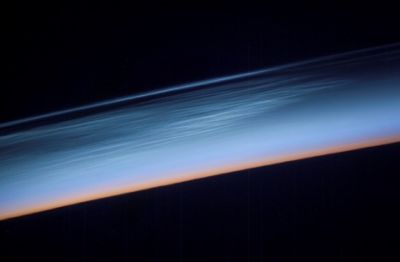
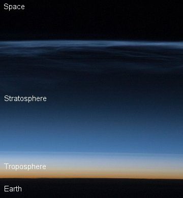
Had I made one different educational choice in life — choosing the meteorology program at the University of Wisconsin rather than the one at Michigan — might have been influenced by the work of Professor Vern Soumi and made satellite interpretation my meteorological specialty. But I did not, and in later years I have often said I should get back to studying satellite meteorology, if only as a side area of interest. So to see clouds from both sides, I have to be able to look down on them, and since I do not fly much anymore, I have to rely on our eyes in the sky: the meteorological satellites with contributions from the astronauts aboard the US Space Shuttles and the International Space Station. And as usual, when I begin compiling my notes for writing these Almanacs, I start by collecting ideas and facts. My Google search revealed an interesting link to the Med Ed Page of the UCAR COMET program, a fabulous collection of meteorological education modules that cover a range of topics from basic materials to specific tools for the professional forecaster. This particular link to “The Satellite Palette” comprised a series of module for indentifying dynamic weather features from satellite imagery. To my surprise the module was authored and presented by my good friend Phi Chadwick. And so again, the worlds of art and science combine. Phil introduces the module by saying that the "Satellite Palette" is both and art and a science. “The real world, says Phil, “is full of patterns and shapes. From the very first time that we crawled out of the cave, humans have developed and refined extraordinary skill at understanding what patterns can tell them.” (A viewpoint I have also long held.) He continues that the “art part relies on the human ability to comprehend complex patterns” in these satellite images. And the “science part provides the basic tools for the forecasters to practice the science of meteorology on the satellite data.” From The Top SideWhile I have not spent as much time studying satellite images as I would have liked, I have allowed the viewing of them to influence my art. In particular, I did one painting based on the visible satellite view of Hurricane Katrina as it hit the US Gulf Coast on 29 August 2005. I have contemplated others, particularly images taken with the “color-enhanced” IR (infrared) sensors which show dramatically the stark contrast between towering cumulus complexes and lower, more benign clouds.  Hurricane Katrina 29 August 2005. painting by Keith C. HeidornOne cloud species that has received a lot of attention of late is the noctilucent cloud. Once rarely seen, they have been prominent in Northern Hemisphere summers over the past several years and many ground-based photographs are posted annually in the Space Weather website. I even added a few in my one observation of these interesting clouds. They are known to be very high-altitude clouds, so high that they are best viewed when illuminated by the sun in the first hours after sunset. A special satellite called AIM (Aeronomy of Ice in the Mesosphere) was launched to study noctilucent clouds. The satellite sent back one of the first images (seen on the left) in May 2007 which shows these wispy clouds from above as the same electric blue and white entities we see from the ground. Even more interesting is the image on the right taken by ISS astronauts on 22 July 2008. Their photograph shows the thin band of electric-blue clouds lying approximately 83 km (51 miles) above the Russian Arctic.
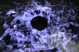
Speaking of Russia, here is a spectacular shot from ISS astronauts of Sarychev Peak Volcano on 12 June 2009. The mushroom-shaped and -colored cloud, a combination of dust and water, from the eruption, is vividly portrayed having punched a hole in the overlying cloud deck. If you look at the lower center of the volcano, a cloud arising from pyroclastic flows can be seen. (NASA/JSC) 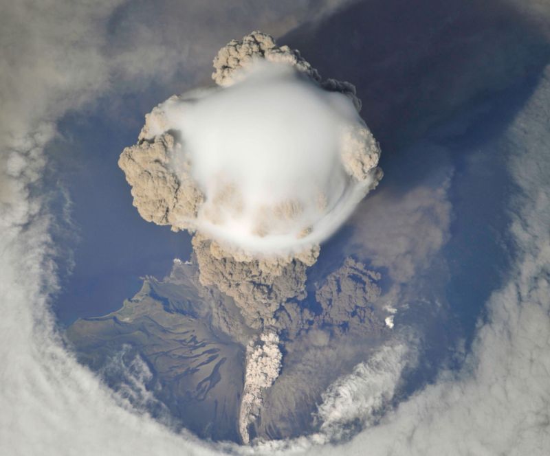 Sarychev Peak Volcano on 12 June 2009 |
|||||||||||||||||||||||||||||||||||||||||||||
 |
 |
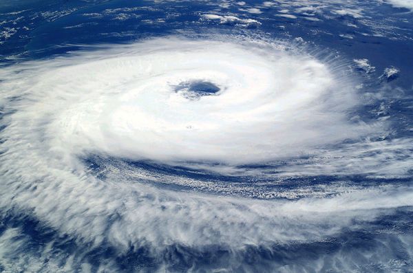
Cyclone Catarina as from the ISS on 26 March 2004. |
Cyclone Catarina on 27 March 2004 off Brazil Coast |
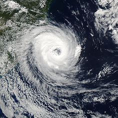
The image below shows a polar cyclone lying over the cold waters of the south Atlantic Ocean taken by a NASA satellite. Note the flowing pattern of the storms circulation and the extensive areas of cumuli dotting the central image.
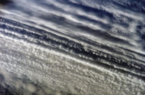
This beautiful abstract-like image below of various cloud layer over the Indian Ocean was taken from the International Space Station on 17 April 2006. I find the cloud bands have an appearance resembling a woven textile pattern.
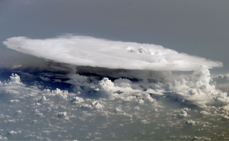
Another incredible ISS image taken on 5 February 2008 shows a large cumulonimbus anvil from above. This storm was located over the west coast of Africa near the Senegal-Mali border. The main cumulonimbus sports the anvil cap while surrounding it, several smaller cumulus towers can be seen.
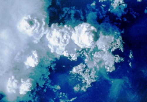
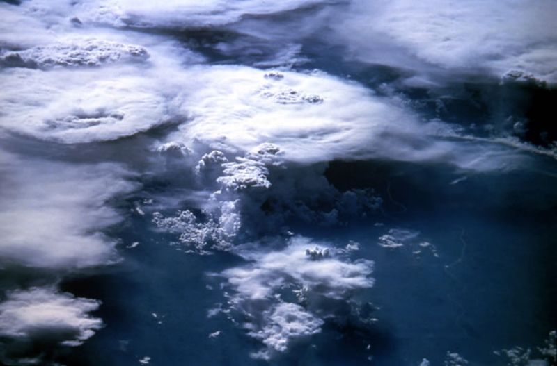
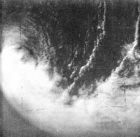
Another couple views of cumuli from above show cloud tops that almost appear to sport faces on them. These thunderheads erupted near Săo Paulo, Brazil in February 1984. They were photographed from almost directly overhead by Space Shuttle (STS 41-B) crew. The second oblique photo was taken a few minutes after the first.
 |
 |
Courtesy LPI/NASA |
Courtesy LPI/NASA |
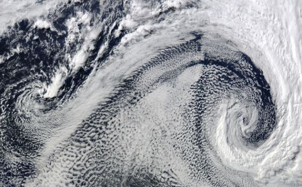
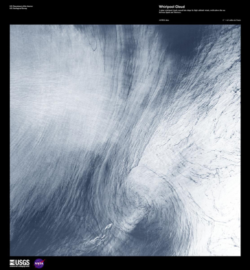
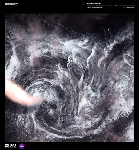
The two images below are cloud “whirlpools” which show atmospheric motion in their stillness. The left image is a spinning formation of ice, clouds, and low-lying fog off the eastern coast of Greenland acquired by Landsat 7 on 1 May 2001. The right image shows an ASTER image of a giant whirlpool cloud, shaped by high-altitude winds, swirling above the sea between Spain and Morocco on 21 August 2002.
 |
 |
Courtesy USGS/NASA |
Courtesy USGS/NASA |
By color-enhancing images which have been acquired from the satellite observations of various spectral wavelengths, weather analysts can see features not always present in the more basic grey-scale renditions. By using false-color to enhance an image, it not only increases the image’s use in weather analyses but also changes it into a thing of beauty.
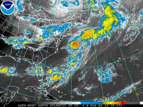
The following image comes from a GOES infrared satellite image for 1815 UTC, 4 August 2004. The satellite’s infrared images usually only show temperature on a simple grey scale from black (warm) to white (cold) in this type of imagery, but using a false-color enhancement on the image makes the coldest temperatures, which represent the highest cloud tops, stand out.
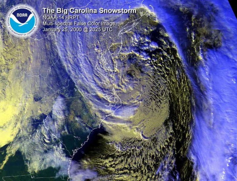
This multi-spectral false color image from NOAA's GOES-8 satellite shows cloud cover in shades of blue and grey. The subject of the image is a major snowstorm located southeast of the Delmarva Peninsula in the Mid-Atlantic as it moved up the US East Coast on 25 February 2000.
I could go on indefinitely with more examples of the beauty of clouds as seen from above but I'll leave further exploration to you. There are many website which compile satellite images, my favorite is NASA’s “Earth Observatory: Image of the Day.” The folks at NASA and the US Geological Survey (USGS) are also seeing the beauty of their Earth images as art and now have this website: Earth As Art.
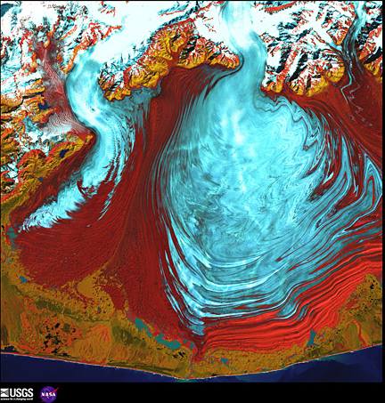
While most of the USGS images are not cloud images, they are spectacularly beautiful. As an example, the Landsat 7 image (1 August 2000) below shows the tongue of the Malaspina Glacier, the Alaska’s largest glacier. It lies west of Yakutat Bay and covers 1,500 sq mi (3,880 sq km).
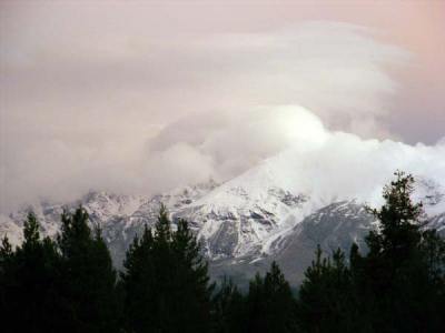
It’s time to return to the planetary surface and look up at the clouds, the "view from down." While only a very few ever get a chance to view clouds directly from outer space and many of us, including myself, don’t get many chances to view clouds from above while flying in an aircraft, almost all of us can see clouds from below. That opportunity is often the highlight of my day. Of late, our local skies have been filled with a fascinating display of cumuli, including some very menacing thunderstorms.
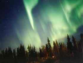 In fact, during the final stages of writing this piece, two days provided incredible skywatching events. The first came just before midnight on 21 July and was not strictly a cloud event. As I arrived home that night, I looked up at the sky, as is my habit, as I was walking to the door and noticed a veil of “cloud” covering most of the northern sky. Normally I would not have stopped for long for a stratus cover, but this night the veil seemed different from a typical cirrostratus deck. Within minutes, the veil began visibly changing, and I soon realized it was not a typical tropospheric cloud, but a “cloud” of aurora borealis. Over the next half hour or so, I witnessed the best aurora display of my life as the veil begat four regions of “curtains” shimmering in the night sky similar to this NWS/NOAA image on the right.. My only regret is that I did not try to photograph the display; I was too mesmerized by it. And, I think I gave up on it too soon as well. I read the next day that it lasted over four hours to the east in Alberta.
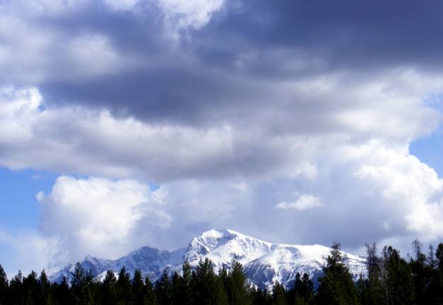
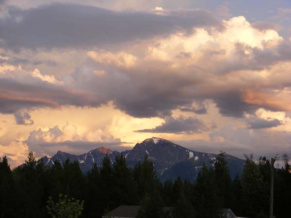
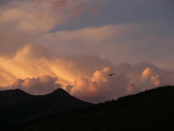
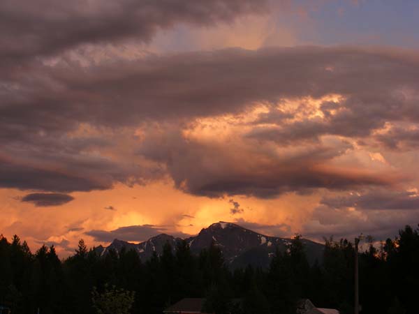
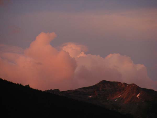
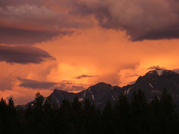
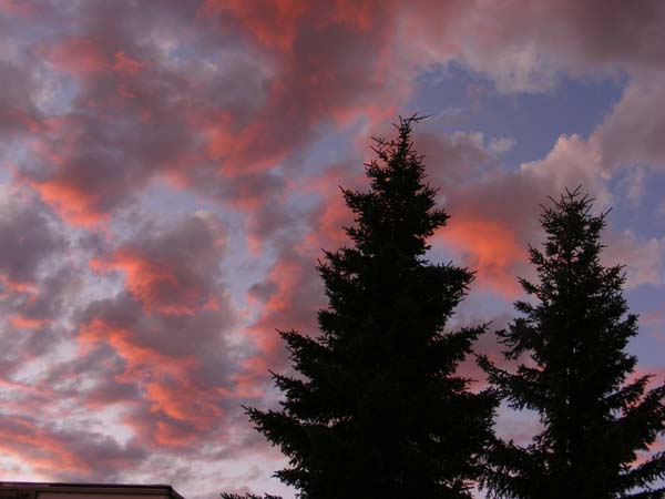
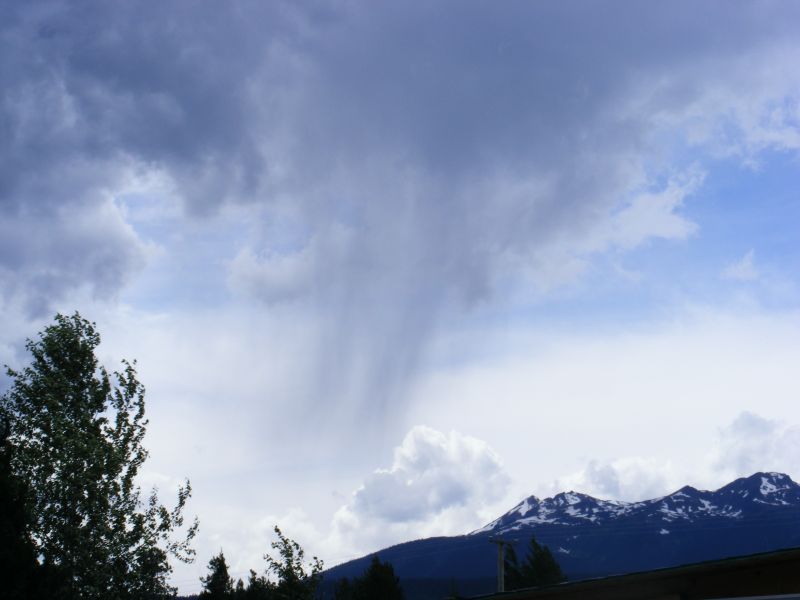
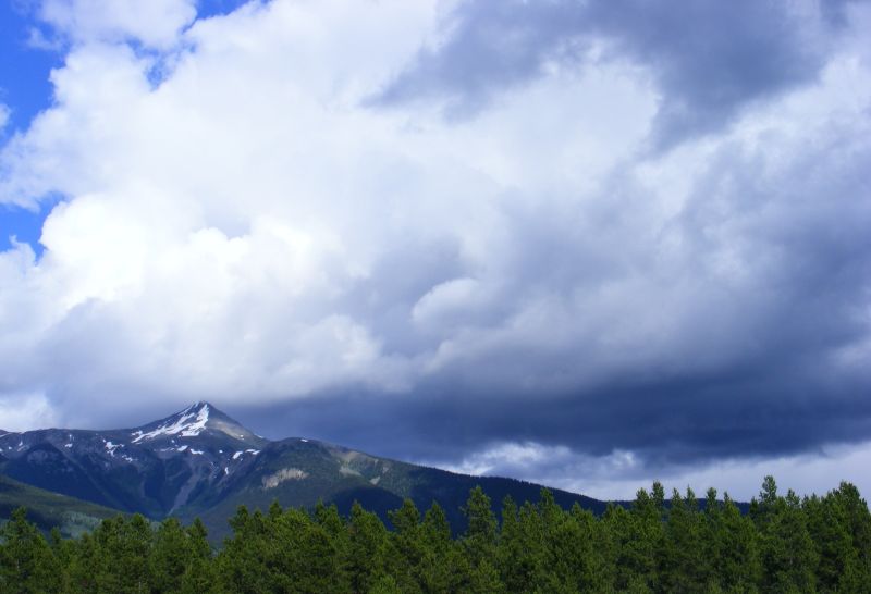
The second event occurred at dusk on Saturday night (25 July). I had spent much of the afternoon on an “edible plants” walk in low-30°Cs (around 90°F) heat and had noticed an unexpected buildup of cumulonimbus over the Rockies and Canoe Mountain, to the north/east and south, respectively. That evening, I was lazily stretched out on the couch watching TV when I noticed the room took on a reddish hue. I looked out and saw the eastern and southern skies ablaze in twilight color. Interestingly, there was little cloud to the west. The photos below are just a sample of the 40 or so I snapped in the hour.
 |
 |
 |
 |
 |
 |
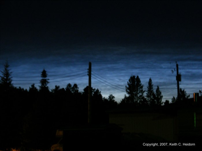
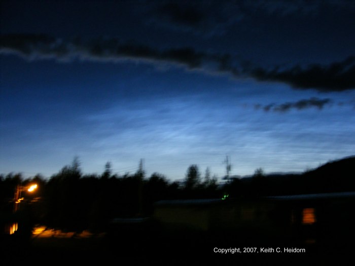
I have also been on the lookout for noctilucent clouds (NLCs) in our skies for the past month or so. According to the Space Weather website, noctilucent clouds seem to be more prevalent during years with minimal sunspot activity, and this year 2009 is one. Displays have been frequent this summer over Europe and noctilucent clouds have recently begun to appear over North America. Therefore, I have begun looking these clouds again. I first saw them in the summer of 2007 and snapped these pictures. I haven’t seen them since but perhaps part of the reason has been that our skies have been filled with lower-level clouds as sunset for much of the early summer.
 |
 |
Dr. Tony Phillips, author of the Space Weather site gives these observing tips for viewing noctilucent clouds:
“Look west 30 to 60 minutes after sunset when the Sun has dipped 6o to 16o below the horizon. If you see luminous blue-white tendrils spreading across the sky, you've probably spotted a noctilucent cloud. Although noctilucent clouds appear most often at arctic latitudes, they have been sighted in recent years as far south as Colorado, Utah and possibly Virginia. NLCs are seasonal, appearing most often in late spring and summer. In the northern hemisphere, the best time to look would be between mid-May and the end of August.”
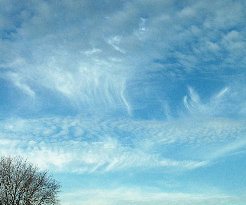
While I wait for noctilucent clouds to appear, I’ll remain content with the interesting displays of cumuli and cirrus. (I did catch a volcano sunset sky recently, dust from the Sarychev Peak Volcano giving a purplish hue to the clear air at sunset.) Evening skies have also been unusually colored due to smoke from the forest fires burning around BC.
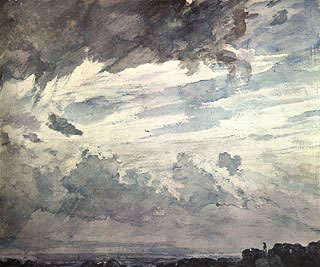
As I mentioned above, I've had a chance to understand how painter Tom Thomson saw the sky, and during the past week, had the opportunity to view a video on how English watercolourist John Constable saw the world around him. Constable lived at the time that Luke Howard had just proposed the cloud-naming system we use today. Constable was one of several contemporary painters, including J. M.W. Turner and Caspar David Friedrich, who took Howard’s work seriously Constable, for one, believed art might assist science. "Painting is a science and should be pursued as an inquiry into the laws of nature," he said in a lecture at the Royal Institute. Constable frequently noted in detail the date and weather conditions on the back of his plein air paintings.
My good friend “Forecaster Phil” Chadwick has not only produced Creative Scene Investigation” analyses of several Tom Thomson’s paintings, but he also spends as much time as he can painting plein air in Ontario. As you would expect, many of his subjects include the weather situation at the time the work was undertaken. The image here Smoke Lake Cumulus is one of his more recent, and you can find more of his paintings and discussions on his blog. With each of his paintings, Phil, like Constable, describes the weather conditions he is depicting. For Smoke Lake Cumulus he had this to say: “The cumulus clouds were well developed and were my main subjects. Jet stream cirrus and cirrostratus were streaming in from the west and heralding the approaching low pressure area and rain. This rain would come to pass as the deformation zone had pushed well to the north of Algonquin Park.”

Many of the photos I take are intended to be precursors for paintings. While I don’t often render the photo exactly as a painting, the shapes give me some inspiration for what goes on the canvas. A few of my cloud paints are shown below. For more information, see my Art Gallery.
 |
 |
 |
 |
In a previous article on this site A Springtime Cloud-Watching Kind Of A Day, I extolled the virtues of taking some time out for springtime cloud-watching, and in the summer heat, it is a good practice as well. Can you see the cloud men? Are there haloes, or sundogs, or coronas? Is there rain and lightning coming from the clouds? Every day is a new adventure and with it a new appreciation of nature.
 |
 |
 |
 |
 |
 |
Since I have given NASA a plug for their websites of satellite images, I must do justice to my fellow cloudwatchers. One particularly good site is Britain’s The Cloud Appreciation Society which has both a “Cloud of the Month” image and a Cloud Gallery, as well as just about everything related to cloudwatching. On this side of the Atlantic, we have For Spacious Skies a program begun by former Boston TV reporter Jack Borden. They have compiled a beautiful and comprehensive cloud chart in collaboration with the late Professor John Day (“Cloud Man”).
 |
To Purchase Notecard, |
Now Available! Order Today! | |
 |
 |
Now |
The BC Weather Book: |


 I have long been fascinated by the beauty of satellite images since I saw the first TIROS images in the early 1960s. Indeed, one of my favorite features of Monthly Weather Review, to which I had a subscription in my later high-school days when the journal was published by the US Weather Bureau, was the “Picture of the Month.” In these early days of satellite meteorology, photos from TIROS and NIMBUS provided most of the choices. I was also enthralled by the NASA books of Earth images produced in this early decade of space exploration, particularly the two volumes of Earth photographs taken during the Gemini missions.