| Home | Welcome | What's New | Site Map | Glossary | Weather Doctor Amazon Store | Book Store | Accolades | Email Us |
 | |||||||||||||||||||||||||||||||||||||||||||||||||||||||||||||||||||||||||||||
Weather Almanac for July 2006HOW HOT CAN IT GET?
|
|||||||||||||||||||||||||||||||||||||||||||||||||||||||||||||||||||||||||||||
US State Maximum Temperature Records Set in 1936 | |||
|---|---|---|---|
| State | Location | Temperature (Degrees F) | Date |
| Arkansas | Ozark | 120 | Aug. 10, 1936 |
| Indiana | Collegeville | 116 | July 14, 1936 |
| Kansas | Alton | 121 | July 24, 1936 |
| Louisiana | Plain Dealing | 114 | Aug. 10, 1936 |
| Maryland | Cumberland and Frederick | 109 | July 10, 1936 |
| Michigan | Mio | 112 | July 13, 1936 |
| Minnesota | Moorhead | 114 | July 6, 1936 |
| Nebraska | Minden | 118 | July 24, 1936 |
| New Jersey | Runyon | 110 | July 10, 1936 |
| North Dakota | Steele | 121 | July 6, 1936 |
| Pennsylvania | Phoenixville | 111 | July 10, 1936 |
| South Dakota | Gann Valley | 120 | July 5, 1936 |
| Texas | Seymour | 120 | Aug. 12, 1936 |
| West Virginia | Martinsburg | 112 | July 10, 1936 |
| Wisconsin | Wisconsin Dells | 114 | July 13, 1936 |
The average daily maximum temperature for the month of July in Kennebec, South Dakota was 106.6oF (41.4oC) with a dozen days exceeding 110oF (43.3oC). Kansas City saw 100oF (37.8oC) or hotter temperatures on 53 days that summer; Lincoln, Nebraska had 41. Of the 88 Ohio weather stations, only three failed to reach the century temperature during July, and each of those fell one degree short.
Many locations also reported record strings of 100oF or more. Lincoln had eleven straight days, Bismark, North Dakota and Chicago, eight; Detroit, seven. Clarendon, Texas was over 100oF for all but two days between 12 July and 27 August.
Over the course of July and August, many cities set temperature records. Some of the more notable, Seymour, Texas melted at 120oF (48.9oC), the Texas state record which still stands. New York's Central Park hit 106oF (41.1oC) as did Duluth, Minnesota; Chicago's Midway Airport reached 104oF (40oC).
And while the bulk of the heat covered the continent east of the Rockies, Anchorage, Alaska had its own version of the heat wave: 43 days with maximum summer temperatures over 70oF (21.1oC), a mark still standing.
The heat waves of 1936 with its heat and high humidity frequently combining to give a heat index exceeding 120oF (48.9oC), and it killed more than 4,768 Americans. The records count 364 dead in Detroit, 570 dead in Michigan, the highest toll for any state.
The heat wave, days with temperatures above 32oC (90oF), also spread into Canada during the first week of July, moving first northward across the central border into southern Saskatchewan, Manitoba and Northwestern Ontario, then spreading eastward into the Ottawa Valley. It began in southern Saskatchewan and Manitoba on 5 July, the hottest period there lasted thirteen days. In Ontario the heat wave lasted 8 days, beginning in the northwest on 7 July and ending across the full province on the 14th.
When the heat finally broke, 780 Canadians, most of whom were elderly and infants, had died from the heat. Another 400 or so were indirect casualties included several who drowned trying to escape the stifling heat. Ontario recorded the greatest number of heat deaths: nearly 600 persons of which 225 died in Toronto. Manitoba's heat-related death toll exceeded 70. By comparison, the previous summer had registered only 42 heat-related deaths. High humidity added to the discomfort and the deadliness of the heat wave.
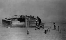
Crops withered under the heat and dryness, and wildfires consumed vast tracts of tinder-dry bush in Ontario and the Prairies. Many fruit withered on the trees and crops wilted. The hot weather caused wheat crop losses estimated at $514 million (1989 US dollars). The heat buckled sidewalks and highways and softened asphalt as ground surface temperatures soared to unimaginable levels. According to David Phillips of Environment Canada, surface temperatures exceeding 65oC (149oF) were measured. Railroad tracks and bridge girders twisted in the heat.
The hottest day occurred in Manitoba. St Albans registered 44.4oC (111oF) on 11 July, and Emerson equalled that mark the following day. These readings still stand as the hottest on record in that province. In Winnipeg, temperatures exceeded 32oC (90oF) for 13 consecutive days, peaking at 42.2oC (108oF) on the 11th, the hottest day on record for that city. That night the minimum temperature recorded was 28.3oC (83oF). In Northwestern Ontario at the town of Atikokan, the hottest day (11 July) reached 42.2oC (108oF) which tied a provincial record set in 1919. Two days later, the mercury soared in Fort Frances to a level which again tied the Ontario heat record. Heat in the eastern region of Ontario did not quite reach that in the west, but it was still stifling, the hottest period ever observed in that part of Canada where weather records extended back nearly a century. Toronto peaked on 10 July at 41.1oC (106oF). The mercury only fell to 26.6oC (80oF) during the following night, setting a new record for highest minimum temperature.
Eastern Canada never reached those extremes of temperature, the record highs for the Maritime Provinces had been set the previous summer in mid-August. However, Newfoundland would see three straight days over 32oC (90oF) in early August, the longest string of such temperatures in provincial history. Saskatchewan would reach record temperature levels, but the highest to ever be recorded there would occur in the following summer.
Three quarters of the US was extremely short of rain, and the heat produced extreme drought conditions. Ludlow, South Dakota had just 2.89 inches (73.4mm) of precipitation that year. Eastern Nebraska saw only 8 percent of its average precipitation total for July, and Iowa only 14 percent of the normal. In Oklahoma, the state-averaged precipitation for August was only 7 percent of expected.
During the summer of 1936, the number of dust storms across the central Great Plains increased to 68 (only 1937 with 72 experience more), and at least four major dust storms swept across the nation.
Seventy years later, temperatures across the United States soared during July. Extreme heat was reported just about everywhere. But hot as it was, the average temperature for the US (in the 48 contiguous states) of 77.2oF (25.1oC) in July fell just shy of the record of 77.5oF (25.3oC) set in July 1936, according to the National Climatic Data Center. July's heat set over 2,300 daily high temperature records across the nation, mostly in the Midwest and West. An additional 3,200 records fell for the warmest nighttime temperatures.
The most pronounced heat wave affected much of the nation from 16-25 July reaching from the Pacific to Atlantic shores. The hottest official temperature, outside the SW desert was 120oF (48.9oC) at Kelly Ranch/Usta, South Dakota. Montana was also baking, major reporting stations showed 20-23 day with temperatures above 90oF (32.2oC). Among the many notable heat events in the month are:
15 July 2006, Pierre, South Dakota: Pierre sets its new all-time daily maximum temperature record: 117°F (47.2°C).
16 July 2006, Valentine, Nebraska: Mercurt soars to daily maximum temperature of 113°F (45°C).
21 July 2006, Western Washington: An unusual heat wave in western Washington breaks five maximum temperature records: Vancouver at 104°F (40°C); Olympia at 100°F (37.8°C); Seattle at 97°F (36.1°C); and Hoquiam at 90°F (32.2°C).
21 July 2006, San Francisco, California: San Francisco International Airport's high of 83°F (28.3°C) broke a 52-year-old record of 80°F (26.7°C).
22 July 2006, Palm Springs, California: Mercury soars to 121°F (49.4°C).
26 July 2006, Death Valley National Park, California: The low temperature for the day bottoms out at a scorching 104°F (40°C). The day's high was only 116°F (46.7°C).
Like the hot month of July, the Summer of 2006, defined as June 1 to Aug. 31 by the National Climatic Data Center, the continental US had an average temperature of 74.5°F (23.6°C). According to the NCDC's Climate Monitoring Branch, this ranks as the second warmest for the nation since 1895, when such records were begun. The warmest US summer on record was the Summer of 1936 with an average of 74.7°F (23.7°C).
Of the US's ten hottest summers, five came during the decade of the 1930s and four, so far, in this opening decade of the 21st Century. The other hot summer came in 1988, and extreme El Niño year.
 |
To Purchase Notecard, |
Now Available! Order Today! | |
 |
 |
NEW! Now |
The BC Weather Book: |


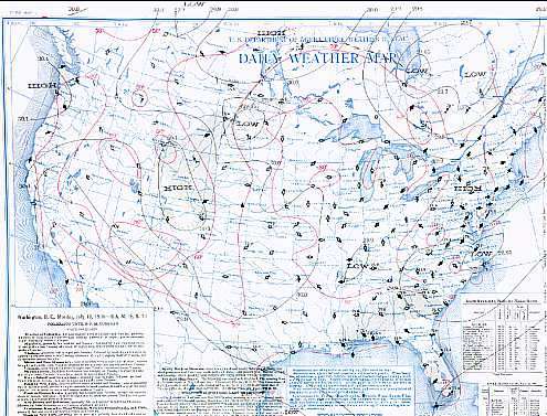
 As July began, the heat spread north and west as a strong upper-level ridge locked itself over the central American Plains. On 5 July, Gann Valley, South Dakota hit 120oF (48.9oC). The next day (6 July), Steele, North Dakota reached 121oF (49.4oC), the hottest temperature ever recorded in the US outside its desert Southwest. It had been quite a year of temperature extremes at Steele. On 15 February, the thermometer had dipped to a bitter 60oF below zero (-51.1oC). That temperature swing within a calendar year of 182 F degrees (101.1 C degrees) would be unprecedented in US Weather annals.